From the GBA
Over the last week, the Great Lakes region experienced persistent cold arctic air, due to a weakening of the strong winds normally associated with a polar vortex. All regions susceptible to lake effect precipitation experienced heavy snow falls. Looking ahead, the region will see a dramatic change to warmer temperatures and further snow is expected in some eastern parts of the basin.
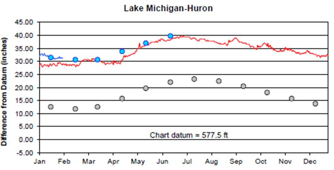
Lake Michigan-Huron is still in its seasonal decline and has 1 inch in the past 30 days, is 3 inches above its level last year, is forecasted to remain at its current level over the next month.
Lake Superior’s outflow through the St. Mary’s River is predicted to be above average in February. Lake Michigan-Huron’s
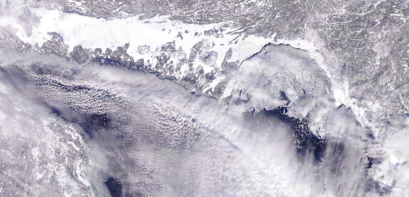
Satellite images are now available following the re-opening of the US government. Cloudy conditions have however covered most of Georgian Bay recently – however we were able to retrieve this image of the north part of the Bay and the North Channel from Jan 27th. The colder weather since then should have expanded ice coverage. Satellite images are now available following the re-opening of the US government.
Best Regards
| Rupert Rupert Kindersley Executive Director (416) 485-5103C: (416) 985-7378 rkindersley@georgianbay.cageorgianbay.ca |